Strathbogie Shire Tacks & Trails:
Nature at Your Pace
Strathbogie Shire invites visitors to explore a diverse network of tracks and trails set among scenic landscapes and historic townships. From gentle walking paths and shared cycling trails to bush tracks winding through native countryside, there are opportunities to enjoy the outdoors at your own pace. Along the way, you’ll discover parks, playgrounds, open spaces, and connecting recreation areas perfect for resting, picnicking, or soaking up the surroundings.
With trails suitable for all ages and abilities, the Shire offers something for everyone—whether you’re seeking an active adventure or a relaxed stroll. These well‑maintained spaces support health, wellbeing, and connection to nature, reflecting the region’s commitment to accessible recreation and inclusive outdoor experiences for locals and visitors alike.
Avenel Heritage and Nature Trail
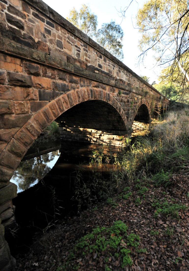
With the discovery of gold to the north, traffic increased substantially. The township became a significant way point for travellers. The crossing was bridged, and Cobb & Co coaches used the nearby Royal Mail Hotel (1847) as a staging post. This historic building is just one of many interesting places you will visit on your walk. Wander past historic buildings & bridges, discover significant sites on the Ned Kelly Touring Route, quirky shops and leafy parks.

Mangalore Floral Walk
Mangalore Nature Conservation Reserve sits beside the Goulburn Valley Freeway. After initially losing 1.5ha from its western side to the construction of the freeway, it has been re-endowed and more than compensated. An addition of 14ha bushland from landholdings on the eastern boundary was made. Surprisingly, the freeway noise is relatively mute.

Balmattum Hill Walking Track
Overlooking the township of Euroa, Balmattum Hill provides walks for all to enjoy with two levels of difficulty. Take in the great views on the 2.4km return walk.

Gooram Falls Trail
Gooram Falls is a great place to visit for a relaxing day by the water. The two cascading falls are a part of Seven Creeks Wildlife Reserve, with the water source being Seven Creeks. There are two small falls roughly 20 metres apart surrounded by indigenous bushland and rocky outcrops. While you are there, you could explore the other natural attractions of the Strathbogie Ranges.

Seven Creeks Walking Track
The Seven Creeks Walking Track was established in 1988 by the Euroa Apex Club as a Bicentennial project. The walking track encompasses the Seven Creeks passing through Floodplain Riparian Woodlands. The track surface ranges from well-maintained asphalt, grassed areas and loose gravel. The Balmattum Hill Walking Track can be access via the southern end of the Seven Creeks Walking Track.
Graytown
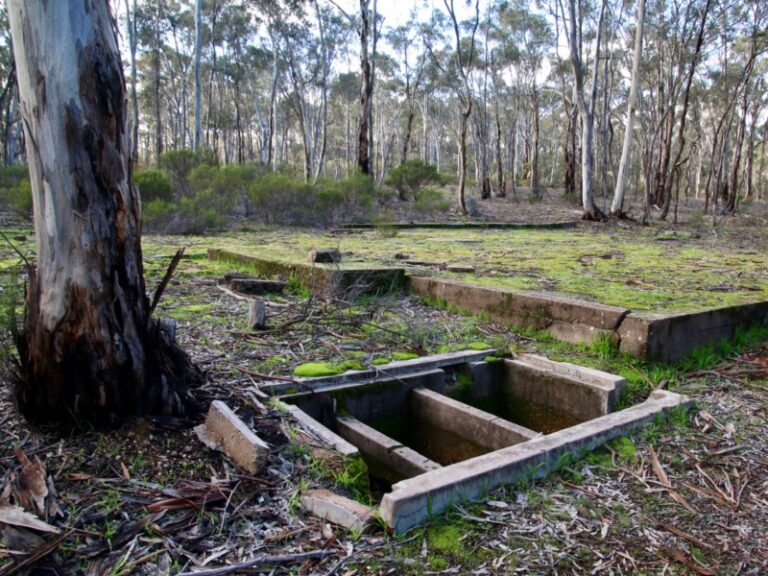
POW Camp, Gold Diggings and Cemetery Walk. This intriguing history walk takes you through the Graytown WWII Prisoner of War Camp site into Heathcote-Graytown National Park and onto the Graytown Cemetery, then back via Graytown gold diggings to close the loop at the old township site.
- Graytown Prisoner of War Camp
- Dirt track to Graytown Cemetery Rd
- Graytown Cemetery
- The Diggings
- Grand Yellow Box tree
- Site of Graytown Township.
- A small corner of Heathcote-Graytown National Park

Melville’s Lookout Track
Melville’s Lookout is named after Captain (Francis) Melville, who was a notorious goldrush era bushranger. Mt Black Quarry can be viewed from the Lookout Track. Granite blocks were mined here to use in the construction of the Goulburn Weir wall in the 1890s.

Lake Nagambie Waterfront Walk
This is an incredibly easy walk where you can take in the views of Lake Nagambie on the pleasant loop from High Street along the waterfront. Pass fishing spots, viewing platforms, barbeque areas and playgrounds to a small beach.

Goulburn Gates Walk
An easy walk for water enthusiasts, park on either side of the river for the return walk and view the four sets of Goulburn Gates that control water flow out of the weir into Northern Victorian’s irrigation system
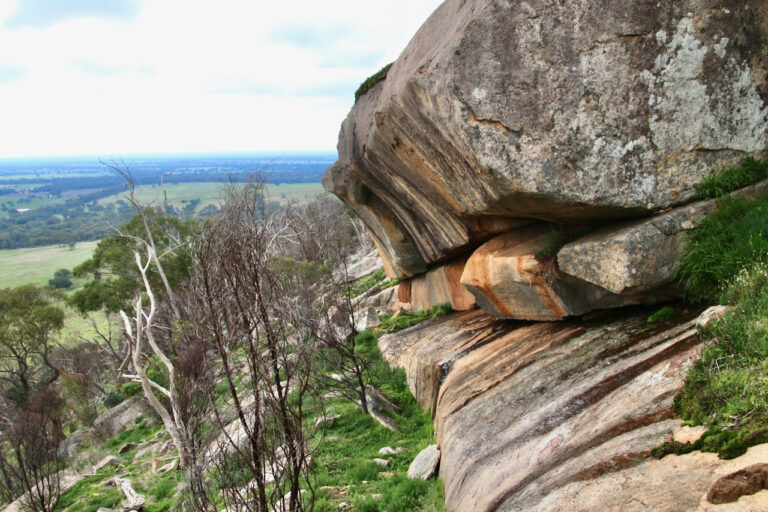
Ridge and Rockface Walk, Tabilk
Walk a ridge line gathering enough elevation to see across grand-scale landscapes. Return along a rock face of intriguing geological formation and small-scale ecosystems.
Tahbilk Eco Trails, Tabilk

Bridge to Bridge Walk
This walk is suitable for all skill levels – an easy walk on mostly flat terrain. There is one steep section on the track which has a handrail for assistance. Keep an eye out for koalas sleeping in the trees.

Cleo’s Track
Experience the grandeur of the recently protected Strathbogie Forest. Descend from dry open woodland into ferny wet gullies and the swampy origins of Seven Creeks. It starts in forest and ends in the same forest, but there are different kinds of forest in between. From the bottom, the only way is up. Inspect a rocky outcrop of stacked granite boulders.
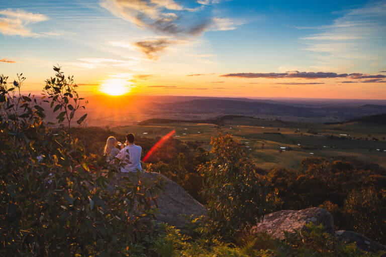
Golden Mountain Walking Track
The track offers a slow ramble towards the peak of Golden Mountain. Walking along old logging tracks you will pass large moss-covered granite boulders, and Eucalypts including Peppermint Gum and Ti-tree thickets. At the summit you will be rewarded with magnificent views to both the east and west.
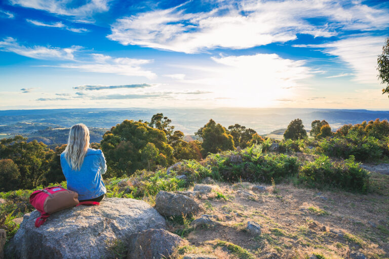
Mt Wombat Flora & Fauna Reserve
Mt Wombat and Garden Range Flora and Fauna Reserve, in the area around Mt Wombat, is perhaps the most well-known nature reserve in the Strathbogie Ranges. Most visitors drive to the top of Mt Wombat for a great view over the Tableland to the east and over the plains to the north and west. But it is also well worth taking the time to venture beyond the track and carpark and explore other parts of the reserve.
Ruffy Snow Gum Reserve Walking Track
Honeysuckle Creek Walking Track
The Honeysuckle Recreational Environment Project began in 2002, and since then has had an active volunteer group taking on the management, preservation, and development of this Reserve area.
Volunteers are planting thousands of native trees, shrubs and grasses in the Reserve. The local primary school and community members are involved in environmental educational activities. An identification brochure for birds that occur along the creek is available locally
Balaclava Mine and Whroo Cemetery Trails
Exploration of the Whroo Historic Trail unearths evidence of a different, busy, crowded and culturally significant past. The open cut of the impressive Balaclava Mine marks one end of the journey. Remnants of Victoria’s gold rush era can be discovered all along the way. Underground storage tanks, mining shafts and tunnels, building rubble and foundations, century old rubbish dumps and gold mining infrastructure comprise an historic treasure trove.
Cycle Routes
The 33km Strathbogie Winery LoopThe Strathbogie Shire has wonderful landscapes that provide the perfect environment for cyclists. Enjoy a vast array of scenery throughout the Shire from the seat of your bike. Whatever your preference and abilities are, Strathbogie Shire has many routes for you to enjoy whether it be meandering through the wineries along the Goulburn River or through the hills of Strathbogie.